
Tick maps on the virtual globe
Global distribution of ticks
This website presents a tick atlas on the virtual globe Google Earth, which is currently still under development. A first kmz file for visualization of Dermacentor reticulatus maps was recently published and can already be downloaded.
Brugger, K., and F. Rubel, 2023:
Ticks Tick Borne Dis., 14, 102102.
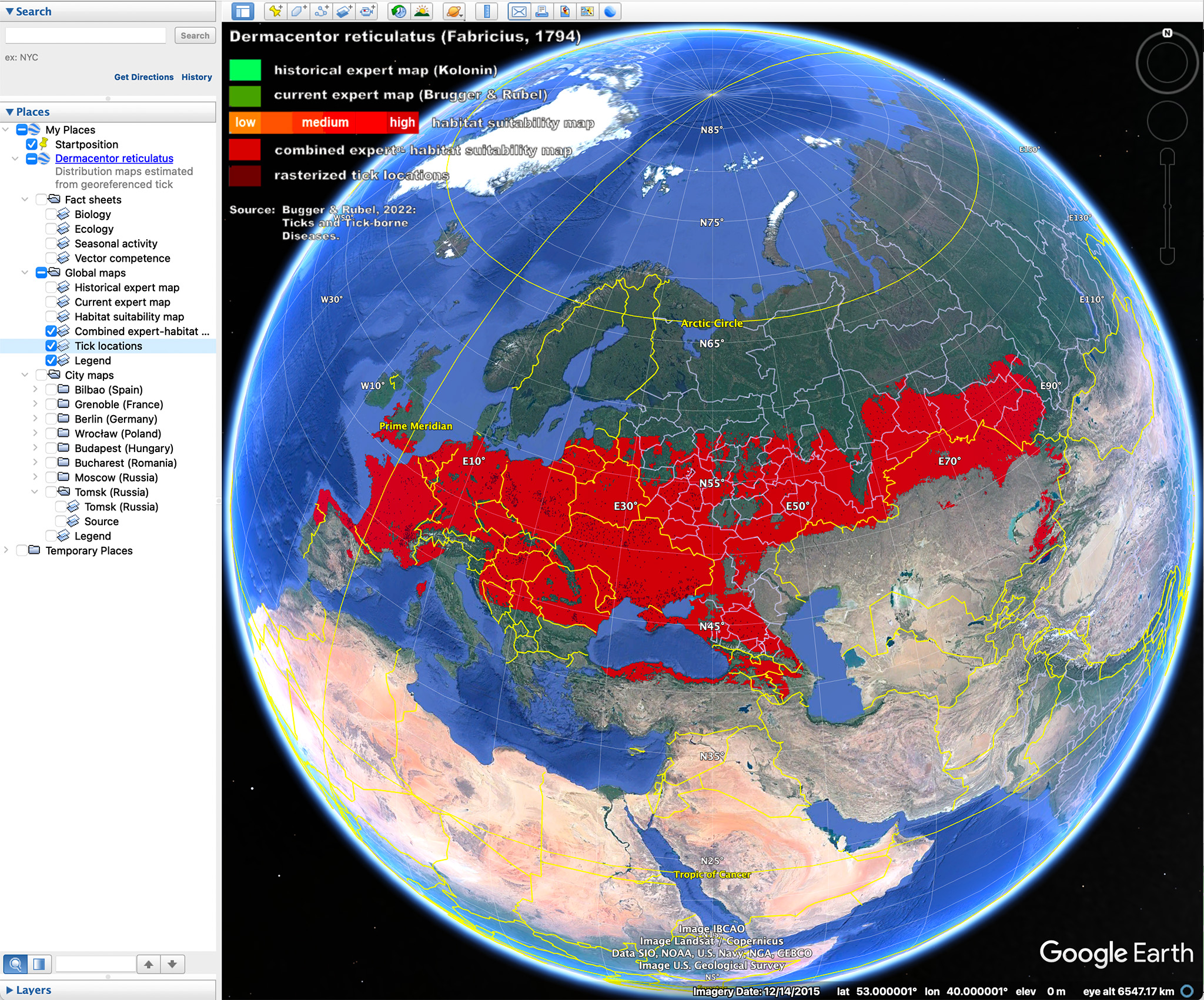
Screenshot of the Google Earth based tick atlas. The first maps were developed for the tick species Dermacentor reticulatus.
Digital maps, particularly displayed on virtual globes, will represent the most important source of geographical knowledge in the future. The best known of these virtual globes is Google Earth, whose use in teaching at schools and universities is now common practice. As the first result of a series of forthcoming digital tick maps, the worldwide distribution of the marsh tick Dermacentor reticulatus is shown on Google Earth. For this purpose, various distribution maps of D. reticulatus were compiled, including digitized expert maps and a map of suitable habitats compiled with a species distribution model (SDM). A random forest model that estimates suitable habitats by combining information from tick observations, bioclimatic variables, altitude, and land cover was chosen for the latter. In the Google Earth application, the following maps can be selected: a historical expert map, a current expert map, a SDM predicted habitat suitability map, a combined expert-habitat suitability map (considered to be the best representation of the current distribution of D. reticulatus), and a map of rasterized tick locations. Users can overlay these maps according to their own requirements or combine it with other Google Earth content. For example, a comparison of the historical with the current expert map shows the spread of D. reticulatus over the past few decades. Additionally, high-resolution city maps of Bilbao (Spain), Grenoble (France), Berlin (Germany), Wroclaw (Poland), Budapest (Hungary), Bucharest (Romania), and Tomsk (Russia) demonstrate the urban distribution of D. reticulatus in public parks, fallow land, and recreational areas. The Google Earth application, developed using the Keyhole Markup Language (KML), also contains fact sheets on biology, ecology, seasonal activity, and vector competence of D. reticulatus. This information has been prepared in a compact and easily understandable way for the target group, i.e. scientists from various disciplines, students, and lay people interested in the geographical distribution of ticks.
Tick map preview
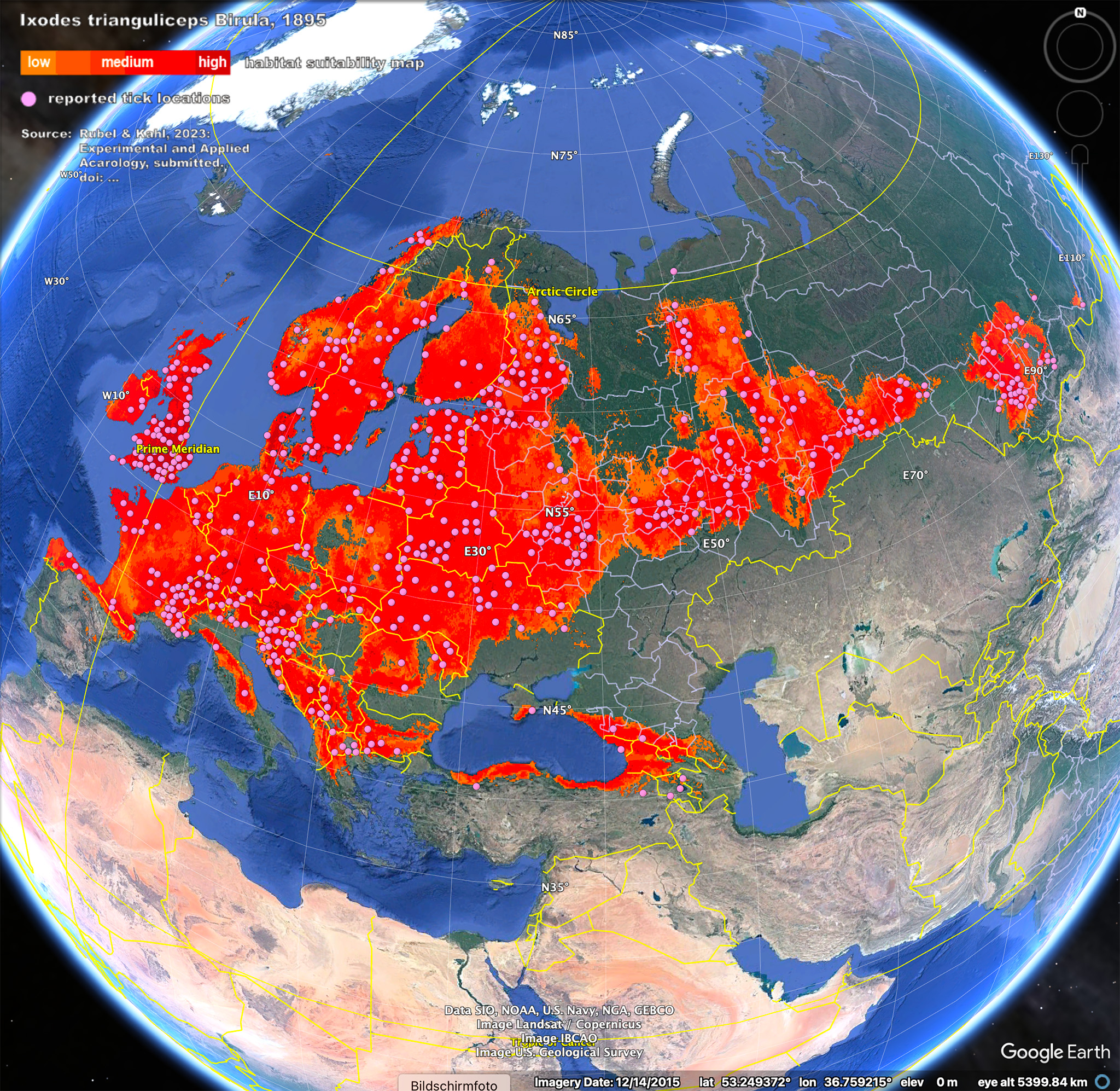
Google Earth screenshot of the global distribution of Ixodes trianguliceps. ![]() Ixodes_trianguliceps.kmz
Ixodes_trianguliceps.kmz
Reference: ![]() Rubel and Kahl (2023).pdf
Rubel and Kahl (2023).pdf
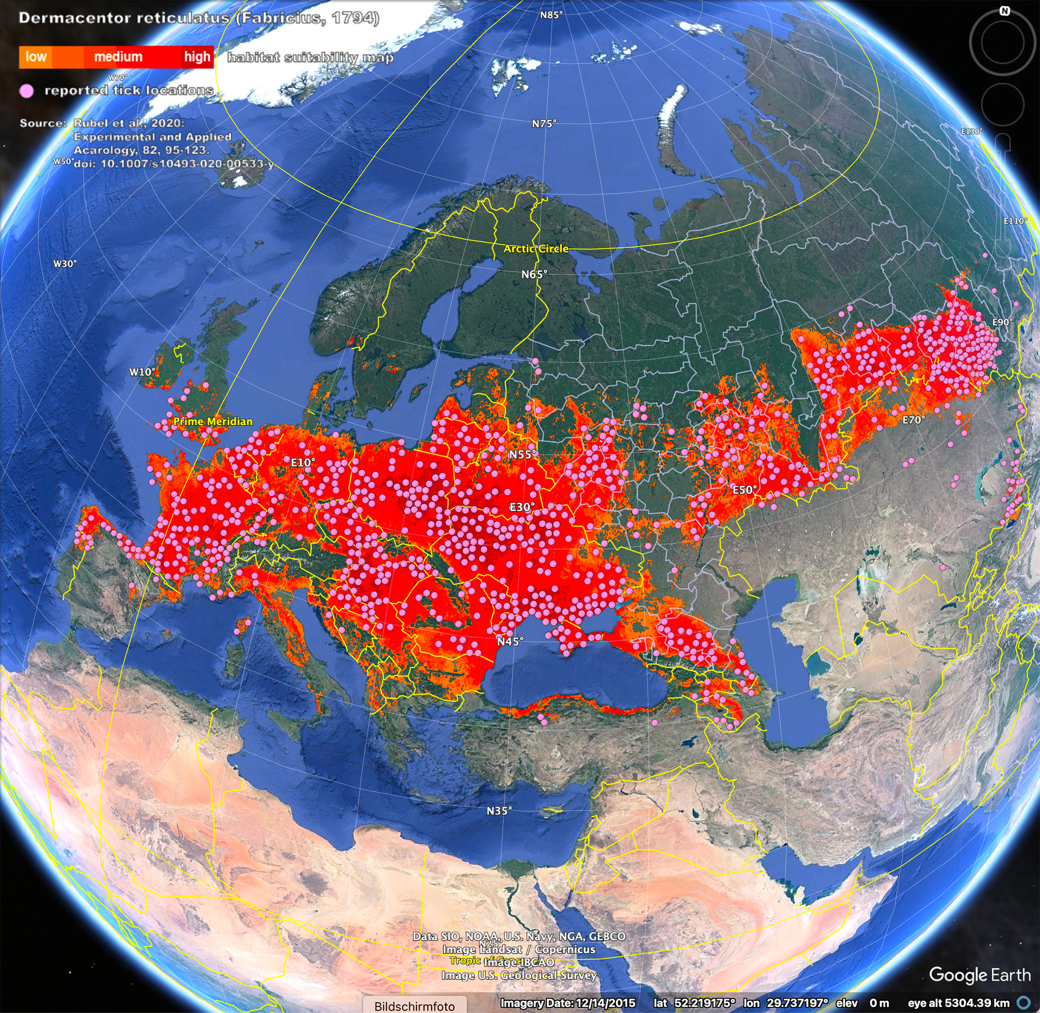
Google Earth screenshot of the global distribution of Dermacentor reticulatus. ![]() Dermacentor_reticulatus.kmz
Dermacentor_reticulatus.kmz
Reference: ![]() Rubel et al. (2020).pdf
Rubel et al. (2020).pdf
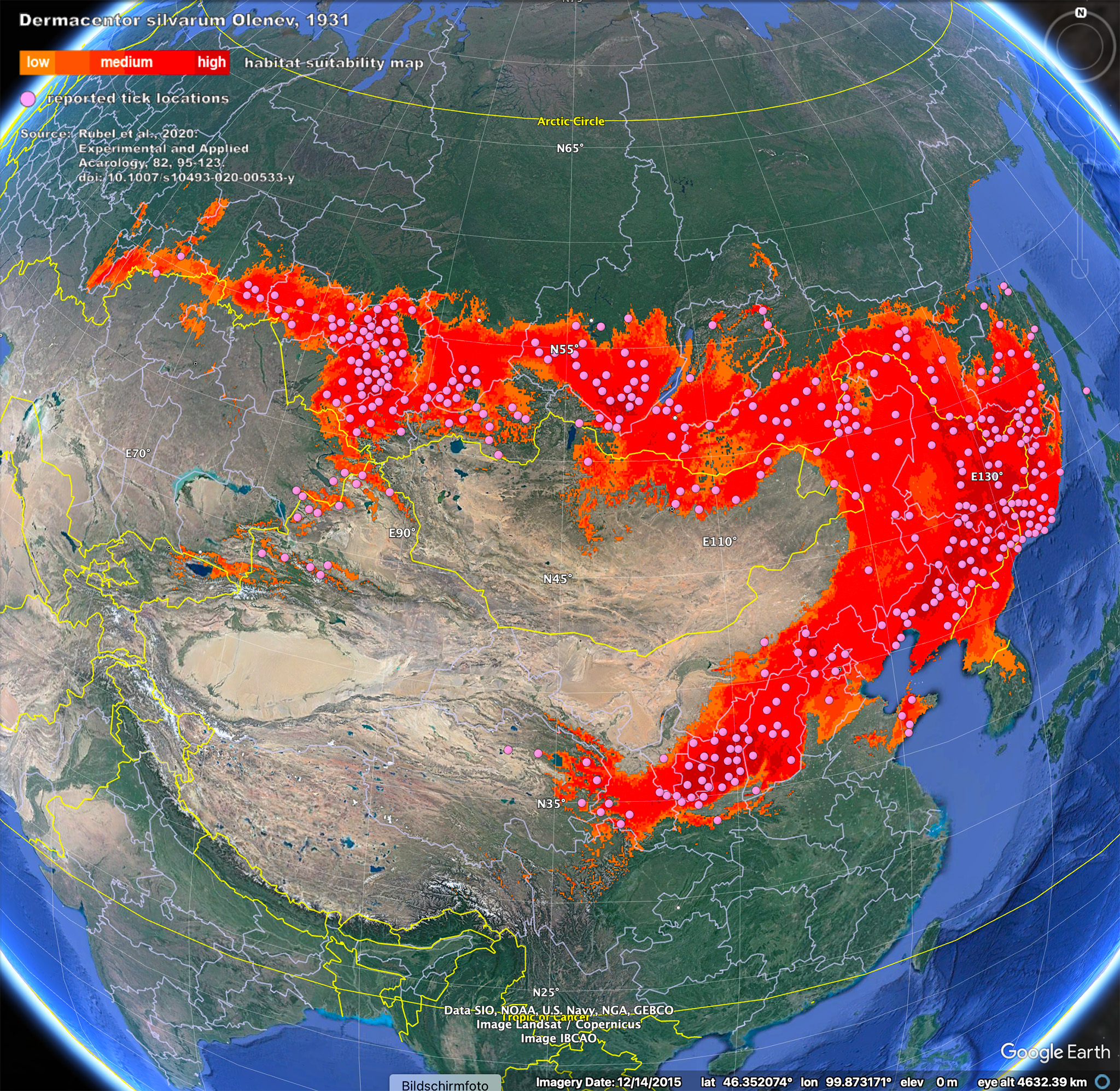
Google Earth screenshot of the global distribution of Dermacentor silvarum. ![]() Dermacentor_silvarum.kmz
Dermacentor_silvarum.kmz
Reference: ![]() Rubel et al. (2020).pdf
Rubel et al. (2020).pdf
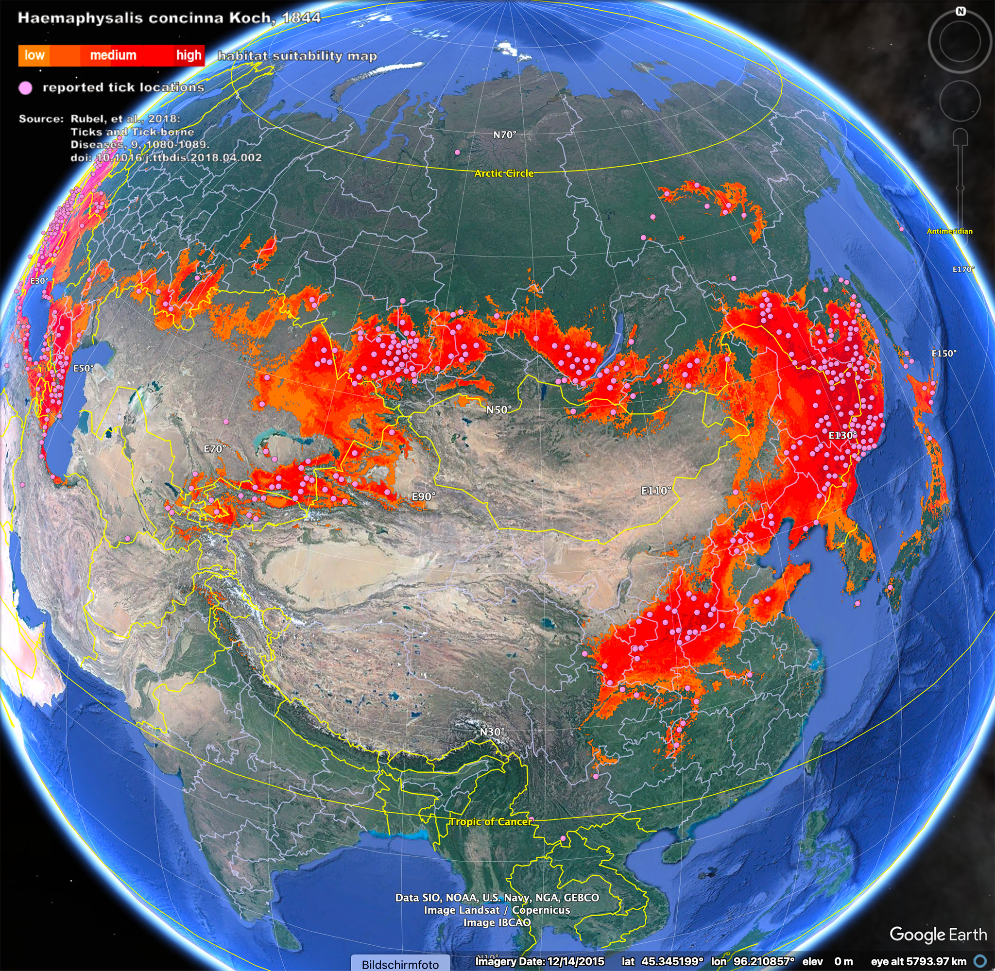
Google Earth screenshot of the global distribution of Haemaphysalis concinna. ![]() Haemaphysalis_concinna.kmz
Haemaphysalis_concinna.kmz
Reference: ![]() Rubel et al. (2018).pdf
Rubel et al. (2018).pdf